溫馨提示×
您好,登錄后才能下訂單哦!
點擊 登錄注冊 即表示同意《億速云用戶服務條款》
您好,登錄后才能下訂單哦!
參考:
1.Basemap繪制中國地圖
2.Basemap生成的圖中繪制軌跡
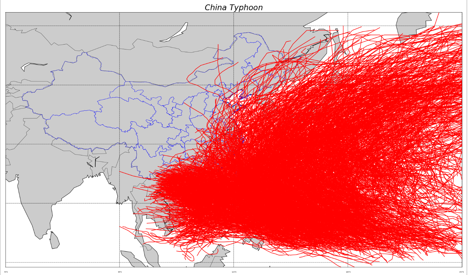
使用CMA熱帶氣旋最佳路徑數據集,對我國周邊的臺風進行繪制
import re
import os
import numpy as np
import matplotlib.pyplot as plt
from mpl_toolkits.basemap import Basemap


path=r"E:\Computer Science\數學建模\第二次模擬賽題\附件"
files= os.listdir(path) #得到文件夾下的所有文件名稱
data=[]
all=[]
for file in files: #遍歷文件夾
  if not os.path.isdir(file): # 判斷是否是文件夾,不是文件夾才打開
    f = open(path + "/" + file) # 打開文件
    tmp=f.readlines()
    for i in tmp:
      line=i.split()
      if(line[0]=='66666'):
        if(len(all)>0):
          data.append(all)
        # print(line)
        all=[]
      else:
        we=(int(line[2])*0.1,int(line[3])*0.1)
        all.append(we)
# print(data)
print(len(data))
CHN='E:\Computer Science\數學建模\python_basemap'
plt.figure(figsize=(20,12))
map=Basemap(llcrnrlon=70,llcrnrlat=2,urcrnrlon=170,urcrnrlat=58)
map.drawcoastlines()
map.drawcountries()
#添加河流
# map.drawrivers(color='blue',linewidth=0.3)
#添加大陸
map.readshapefile(CHN+'\gadm36_CHN_shp\gadm36_CHN_1',
         'states',color='blue',drawbounds=True)
map.readshapefile(CHN+'\gadm36_TWN_shp\gadm36_TWN_1',
         'taiwan',color='blue',drawbounds=True)
#添加經緯線
parallels = np.linspace(3,55,5)
# print(parallels)
map.drawparallels(parallels,labels=[False,True,False,False],fontsize=5)
meridians = np.linspace(70,170,5)
# print(meridians)
map.drawmeridians(meridians,labels=[False,False,False,True],fontsize=5)
plt.rcParams['savefig.dpi'] = 300 #圖片像素
plt.rcParams['figure.dpi'] = 300 #分辨率

ans=1
x=[]
y=[]
for typhoon in data:
  length=len(typhoon)
  print("%d is process!" % ans)
  ans += 1
  for i in range(length):
    x.append(typhoon[i][1])
    y.append(typhoon[i][0])
  # print(x,y)
  # map.plot(x, y, 'c*-', linewidth=2)
  map.plot(x, y, color='r',linewidth=1.5)
  x = []
  y = []
map.fillcontinents()
plt.title(r'$China\ Typhoon$',fontsize=24)
# plt.ylim(70, 170)
# plt.xlim(2, 58)
plt.show()
效果圖:

以上就是使用Python繪制臺風軌跡圖的示例代碼的詳細內容,更多關于Python繪制軌跡圖的資料請關注億速云其它相關文章!
免責聲明:本站發布的內容(圖片、視頻和文字)以原創、轉載和分享為主,文章觀點不代表本網站立場,如果涉及侵權請聯系站長郵箱:is@yisu.com進行舉報,并提供相關證據,一經查實,將立刻刪除涉嫌侵權內容。